The waters surrounding the Bolivar Peninsula and Galveston hold a wealth of fascinating details—where tides rise and fall, currents shift, and ships navigate the vast shipping channel to ports near and far. Whether you’re a beachgoer, angler, or just curious about the Gulf, understanding the dynamics of this marine environment adds a whole new appreciation to coastal living.
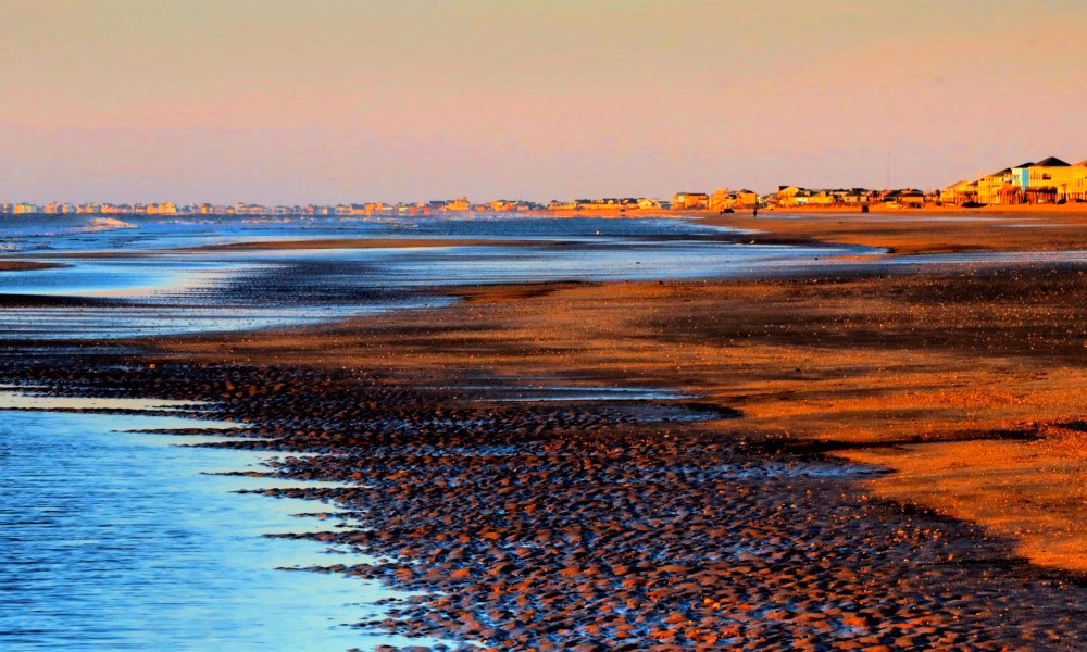
The Rhythm of the Tides
– Tidal Patterns: The Gulf of America primarily experiences diurnal tides (one high tide and one low tide per day), though semidiurnal tides (two highs and two lows) can also occur depending on seasonal and lunar influences.
– Causes of Tides: The gravitational pull of the moon and sun plays a major role. Proximity to the Galveston Bay system amplifies or moderates some tidal fluctuations.
– What to Watch For:
– Spring tides (higher highs and lower lows during new and full moons).
– Neap tides (less pronounced highs and lows during the first and third quarter moons).
Fun Fact: Tidal information is crucial for ferry schedules, fishing success, and even spotting wildlife like crabs and seabirds scavenging during low tide.
Gulf Currents: Flow and Force
– Coastal Currents:
– Strong east-to-west longshore currents are common along the Gulf coastline, moving sand, debris, and marine life parallel to the shore.
– During storms or high winds, rip currents form—narrow, fast-moving channels that can pull swimmers offshore.
– Seasonal Changes: During hurricane season, shifts in atmospheric pressure influence the strength and direction of currents.
– The Loop Current: Though hundreds of miles offshore, the Loop Current plays a major role in regulating Gulf water temperatures, indirectly influencing tides and local weather.
Ocean Depths: The Shallow Shelf and Deep Channel
– Coastal Shelf: The Gulf of America near Bolivar Peninsula has an average depth of around 30-50 feet in nearshore waters. The continental shelf extends roughly 50 to 60 miles offshore before dropping steeply at the continental slope. This gradual transition zone makes the Gulf’s waters shallow for a significant distance compared to the deeper open oceans.
– Shipping Channel: The Houston Ship Channel is a vital artery, dredged to a depth of 45 feet and extending over 50 miles inland to accommodate large vessels.
– Oil Rigs and Beyond: Oil platforms start appearing between 10-20 miles offshore, where waters are shallow enough to anchor fixed rigs, while deeper water rigs can be found beyond the 100-mile mark in depths of over 1,000 feet. Just beyond the coastal shelf, the seabed drops dramatically, reaching depths of over 14,000 feet in the Gulf’s deepest regions near the Sigsbee Deep.
Composition of Gulf Waters: What’s in the Water?
– Salinity Levels: Gulf waters have higher salinity compared to the Atlantic due to evaporation, limited freshwater inflows, and the semi-enclosed nature of the basin.
– Temperature: Shallow areas along Bolivar can warm up to 90°F in summer, making for pleasant swimming. However, cooler waters from deeper channels and seasonal cold fronts can lower temperatures in fall and winter.
– Wildlife-Rich Ecosystem: The waters teem with marine life—migratory fish, dolphins, and plankton blooms, which also attract larger predators.
The Houston Ship Channel: An International Superhighway
– Global Shipping Routes:
– As one of the busiest shipping routes in the world, the channel accommodates thousands of vessels annually, transporting goods such as crude oil, chemicals, and machinery.
– Large oil tankers, container ships, and tugboats are frequent sights from the ferry.
– Historical Fact: Completed in 1914 and widened over the decades, the channel is a marvel of human engineering, transforming Houston into a global trade powerhouse.
Additional Cool Facts to Know
– Sediment Flow: The Gulf waters around Bolivar are known for their murky color due to sediment from the Mississippi and Brazos Rivers.
– Hurricanes and Storm Surges: The unique topography of the Gulf makes the coastline vulnerable to surges during tropical storms and hurricanes, as seen in notable events like Hurricane Ike (2008).
– Dolphin Watching: The confluence of tidal currents makes areas like Galveston Bay and the ferry route hotspots for spotting bottlenose dolphins.
Practical Tips for Visitors and Locals
– Fishing: Check tide charts and current patterns for the best catches—fish like redfish and speckled trout love tidal flow zones.
– Safety: Be aware of rip currents—if caught, swim parallel to the shore rather than directly back.
– Ship-Spotting: Download marine tracker apps (such as VesselFinder.com) to identify passing vessels in real time.
Whether you’re watching massive ships drift by, marveling at dolphins playing in the surf, or simply enjoying a day on the beach, the Gulf’s tides, depths, and currents are an integral part of life on the Bolivar Peninsula. Taking time to understand the natural forces at play deepens your connection to this dynamic coastal environment.


Jeffery S Andrews
September 23, 2025 at 6:34 amGood article, loved the aquatic details but wondered if the author was intentionally referring to the gulf as the “Gulf of Mexico” for any particular reason or if this was simply a recycled article sans updating ?
Margie
September 23, 2025 at 7:48 amGreat read. Really enjoyed it.